Dubai Metro Map 2026: All Stations Explained

The Dubai Metro is a critical part of Dubai’s transportation. Spanning all over the city with numerous stations, the rail network brilliantly connects the whole of Dubai, making it possible for travelers to easily explore and commute around the city. Get familiar with the Dubai metro system and map.
Table Of Content
Overview of the Dubai Metro
The Dubai Metro is a rail transportation network system in Dubai with over 50 stations dotted across several locations in the city. The urban metro system operates along a map known as the Red Lines and Green Lines, which runs across the populated areas of the emirates and indicates the layout routes for easy map reading.

The Dubai Metro is also integrated with buses, trams, and marine transport, with more extensions coming with the planned Blue Line. To ride the Dubai Metro, passengers need a Nol card or ticket, which enables digital fare payments and smooth boarding.
Checkout: Dubai Metro Timings
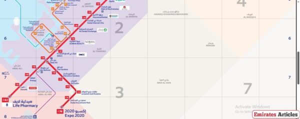
Dubai Metro Red Line: Map Explained
The Red Line is the longest and most prominent line in the Dubai Metro network, stretching approximately 67 km from Centrepoint in the east to Expo 2020 in the west. It primarily runs parallel to Sheikh Zayed Road, connecting major commercial, residential, and tourist areas across the city, Below is the full list of the Red Line stations as they run east to west:

- Centrepoint (R11): Located in Al Rashidiya, this station offers access to Al Rashidiya Park and City Centre Mirdif.
- Emirates (R12): Situated near Dubai International Airport, it’s adjacent to the Emirates Group headquarters.
- Airport Terminal 3 (R13): Direct access to Dubai International Airport’s Terminal 3.
- Airport Terminal 1 (R14): Serves Terminal 1 of Dubai International Airport.
- GGICO (R15): Close to Dubai Creek Golf & Yacht Club and Dubai Duty Free Tennis Stadium.
- City Centre Deira (R16): Provides access to City Centre Deira Mall and Deira Clock Tower.
- Al Rigga (R17): Located in a bustling commercial area with numerous hotels and restaurants.
- Union (R18): An interchange station connecting the Red and Green Lines; near Al Ghurair Centre and Dubai Creek.
- BurJuman (R19): Another interchange with the Green Line; adjacent to BurJuman Mall and close to Al Seef and Karama.
- ADCB (R20): Located in Al Karama, near Karama Centre and local markets.
- Max (R21): Formerly Al Jafiliya; close to Zabeel Park and Dubai Frame.
- World Trade Centre (R22): Serves the Dubai World Trade Centre, a major exhibition and event venue.
- Emirates Towers (R23): Near the Emirates Towers complex and the Museum of the Future.
- Financial Centre (R24): Provides access to the Dubai International Financial Centre (DIFC).
- Burj Khalifa/Dubai Mall (R25): Closest station to the Burj Khalifa, Dubai Mall, and the Dubai Fountain.
- Business Bay (R26): Serves the Business Bay district; near the Dubai Canal and Executive Towers.
- ONPASSIVE (R29): Located near Al Safa; provides access to Kite Beach and Oasis Mall.
- Equiti (R31): Formerly First Gulf Bank; close to Gold & Diamond Park.
- Mall of the Emirates (R32): Direct access to Mall of the Emirates and Ski Dubai.
- Mashreq (R33): Near Al Barsha Pond Park and residential communities.
- Dubai Internet City (R34): Serves Dubai Internet City and Barsha Heights (TECOM).
- Al Fardan Exchange (R35): Formerly Al Khail; close to Emirates Golf Club and American University in Dubai.
- Sobha Realty (R36): Provides access to Dubai Marina and connects to the Dubai Tram.
- DMCC (R37): Located in Jumeirah Lakes Towers; also connects to the Dubai Tram.
- Jabal Ali (R38): An interchange station; serves the Jebel Ali Free Zone.
- Ibn Battuta (R39): Adjacent to Ibn Battuta Mall, themed after the travels of the explorer.
- Energy (R40): Near Festival Plaza and Gurunanak Darbar Sikh Temple.
- Danube (R41): Serves residential communities in Jebel Ali.
- UAE Exchange (R42): Terminal station; provides access to surrounding industrial areas.
- The Gardens (R70): Located in The Gardens residential area.
- Discovery Gardens (R71): Serves the Discovery Gardens community.
- Al Furjan (R72): Provides access to the Al Furjan residential development.
- Jumeirah Golf Estates (R73): Underground station serving the Jumeirah Golf Estates community.
- Dubai Investment Park (R74): Underground station; serves the Green Community and Dubai Investment Park.
- Expo 2020 (R76): Terminal station; provides access to the Expo City Dubai site.
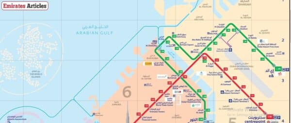
Dubai Metro Green Line: Map Explained
The Dubai Metro Green Line spans approximately 22.5 km, connecting the northeastern and southwestern parts of Dubai. It runs from Etisalat by e& in Al Qusais to Creek in Al Jaddaf, serving 20 stations that provide access to residential neighborhoods, commercial hubs, cultural sites, and healthcare facilities.

Below is the full list of the Green Line stations as they run northeast to southwest:
- Etisalat by e&: Terminal station with a large park-and-ride facility; serves the Al Qusais area.
- Al Qusais: Located in a residential and commercial district; near Al Qusais Pond Park.
- Dubai Airport Free Zone (DAFZA): Adjacent to the Dubai Airport Free Zone; close to Dubai International Airport.
- Al Nahda: Serves the Al Nahda residential area; near Al Bustan Centre.
- Stadium: Close to Rashid Stadium and Al Mulla Plaza.
- Al Qiyadah: Near Dubai Police Headquarters; features an air-conditioned walkway to nearby commercial centers.
- Abu Hail: Serves residential neighborhoods; near Abu Hail Centre.
- Abu Baker Al Siddique: Located in a commercial area; close to Hamarain Centre and Al Muteena Park.
- Salah Al Din: Adjacent to Al Ghurair Centre and Reef Mall.
- Union: Major interchange station with the Red Line; near Al Ghurair Centre and Dubai Creek.
- Baniyas Square: Located in the Deira commercial district, near Naif Souk and Al Manal Centre.
- Gold Souq: Provides access to the famous Gold Souk, Spice Souk, and Deira Fish Market.
- Al Ras: Close to Sheikh Saeed Al Maktoum House and Al Ahmadiya School.
- Al Ghubaiba: Near Al Shindagha Museum, Al Fahidi Fort, and the Al Ghubaiba Bus and Marine Stations.
- Sharaf DG: Located in Bur Dubai, close to Dubai Museum and Al Seef promenade.
- BurJuman: Interchange station with the Red Line, adjacent to BurJuman Mall and Al Seef.
- Oud Metha: Serves the Oud Metha area; near Rashid Hospital and St. Mary’s Catholic Church.
- Dubai Healthcare City: Located in the Dubai Healthcare City district, close to Wafi Mall and Dubai Dolphinarium.
- Al Jadaf: Serves the Al Jadaf area, near Jaddaf Waterfront and cultural centers.
- Creek: Terminal station; provides access to the Mohammed Bin Rashid Library and Al Jaddaf Marine Transport Station.
Renamed Dubai Metro Stations
As of recently, some changes were made to the names of certain Dubai metro stations. The table below highlights these metro stations, their former names, and their current new names:
| Current Name of Station | Map Category | Previous Name |
| Life Pharmacy Metro Station | Red Line | Jebel Ali and UAE Exchange |
| Al Fardan Exchange | Red Line | Al Khail |
| Al Garhoud Metro Station | Red Line | Garhoud and GGICO |
| InsuranceMarket | Red Line | Sharaf DG and Mashreq |
| Sharaf DG | Green Line | Al Fahidi |
| Centrepoint | Red Line | Al Rashidya |
| Max | Red Line | Al Jafilila |
| Sobha Realty | Red Line | Dubai Marina and DAMAC Properties |
| BurJuman | Red Line & Green Line | Khalid Bin Al Waleed |
| Gold Souq | Green Line | Palm Deira |
| Onpassive | Red Line | Al Safa |
| ADCB | Red Line | Al Karama |
| Equiti | Red Line | Umm Al Sheif |
| Energy | Red Line | DUBAL |
| Danube | Red Line | Jebel Ali Industrial |
| DMCC | Red Line | Jumeirah Lake Towers (JLT) |
| Jabal Ali | Red Line | Nakheel Harbour & Tower |
| Etisalat by e& | Green Line | Etisalat Station |
Dubai Metro Map PDF
You can view the PDF of Dubai Metro’s map “From Here“. The document contains the Dubai Metro Red Line and Green Line maps and list of all stations. You can either view the PDF online or download it.
Conclusion
The Dubai Metro map connects the people and the city, running along major landmarks and having stations near several malls and hotels for easy access. Get familiar with the metro stations around your area, including the stations around centers and sites you plan on visiting in the city.
Questions & Answers
The main lines of the Dubai Metro are The Red Line, which runs from Centrepoint to UAE Exchange, and the the Green Line, which connects Etisalat by e& to Creek.
You can use a Nol Card or ticket, a contactless smart card, to pay for metro rides.
Official maps are available on the Roads & Transport Authority (RTA) website and at all metro stations.
Union and BurJuman stations are key interchange points where passengers can transfer between the Red and Green Lines.
Yes, passengers can carry luggage, but it should not obstruct other commuters.
